The NEXTransit Network:
Proposed Projects
Top 10 Proposed Projects
NEXT Projects


0-5 Years


5-15 Years


Explore the map to see what projects are near you.
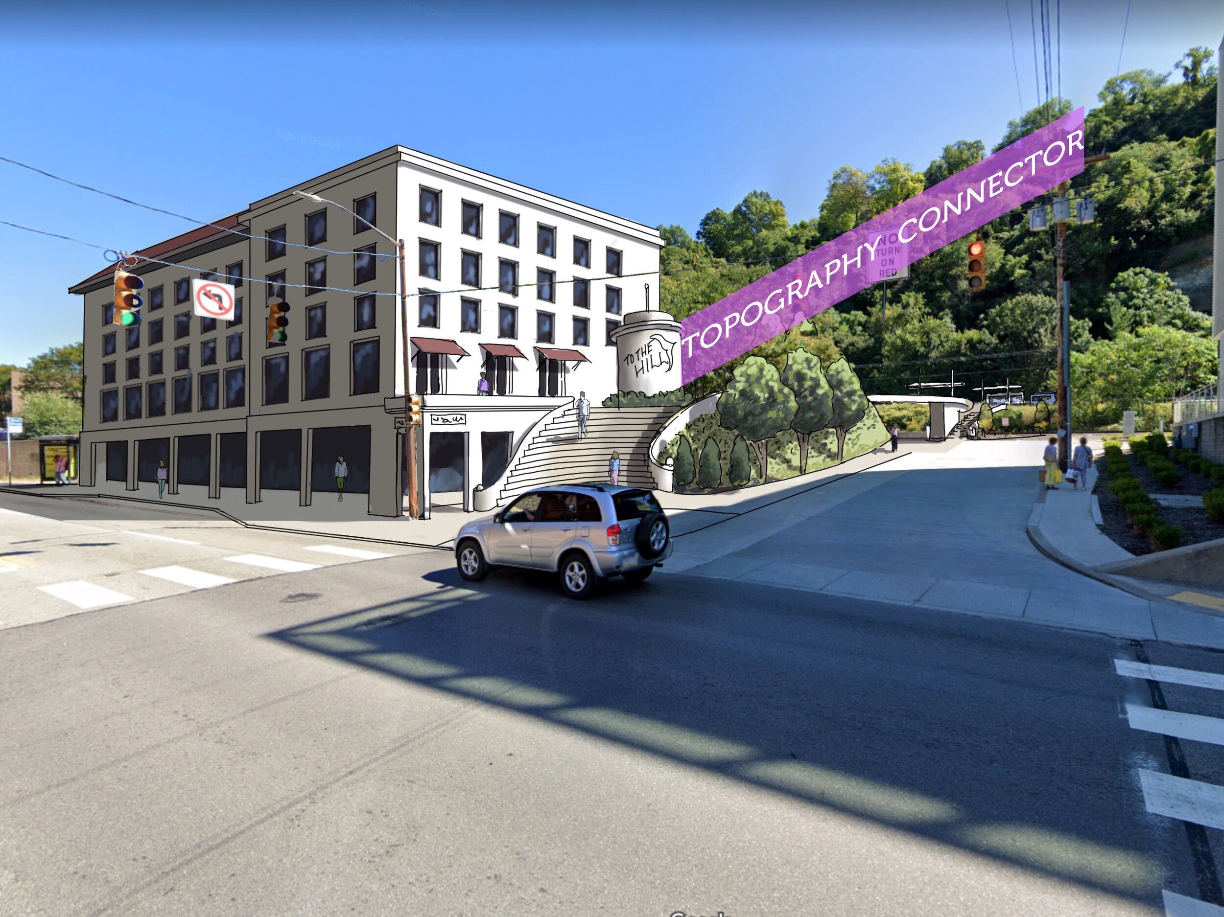
Study the potential for a new transit connection between the Strip District, Hill District, Oakland, Hazelwood, and points across the Monongahela River towards Overbrook and areas in the South Hills in need of direct Oakland connections. This study should also include the potential for this connection to be made via Second Avenue to tie in with the Downtown-Uptown-Oakland-East End Bus Rapid Transit project so as not to create redundancies if it is advanced before the Second Avenue corridor project. This new connection should include study of both a new station in the Strip District along the East Busway and a vertical connection between the Strip District or Northeastern Downtown Pittsburgh and the Hill District.
1. East/Central Pittsburgh River to River Connection

2. Downtown Transit Center
PRT is already underway with a study of the Central Business District's bus network in partnership with the Pittsburgh Downtown Partnership (NEXTransit Downtown) - this study will include a at least one network option which incorporates a larger transit hub into the Downtown core. While a location has not yet been selected, NEXTransit offers some basic criteria for discussion purposes that will help to advance public review and selection of alternatives (and the requirements that will be used to create the alternatives).
Downtown is the center of PRT’s transit network, and while NEXTransit presents several options for future connectivity that aim to create better neighborhood-to-neighborhood connections that don’t require riders to pass through or connect Downtown if it’s not on their way. The core rapid transit network currently terminates routes in or near Downtown, but in the future, through routing across the County from east to west or north to south with Downtown as a central hub may be feasible. It is already possible based on where busways and light rail assets are located, but a transit hub that can provide flexible connections is necessary to not only make these connections comfortable and consistent, but also easy to understand.
3. Library Line Best Use Study
PRT will undertake a study of the Library Line due to its imminent need for $450 million worth of infrastructure upgrades to ensure that the best use of capital needs long-term is determined. This could include changing service or mode uses of the line or focusing on the infrastructure in place and ways to partner with municipalities to improve its usage.
(shown as Project D on the map)


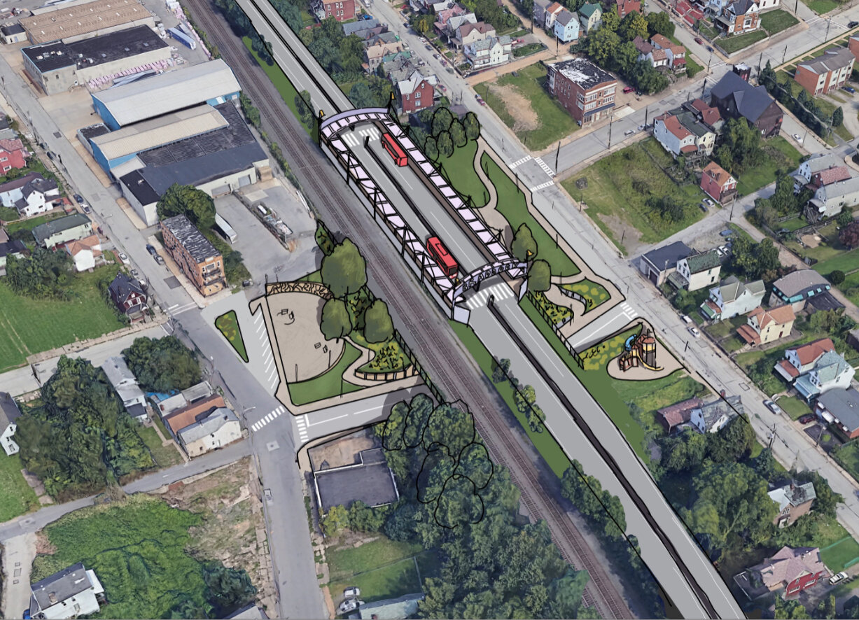
4. Homestead to McKeesport Upgraded Transit
Design transit and right-of-way solutions along this corridor that support transit riders through stop optimization, shelter placement, accessible pedestrian pathways, transit reliability and travel time improvements for transit vehicles. This corridor would extend the types of improvements planned by the Downtown - Uptown - Oakland - East End Bus Rapid Transit project along the existing 61C bus route. Also, this project would include the potential for a major transit hub in Homestead with local service tie-ins.

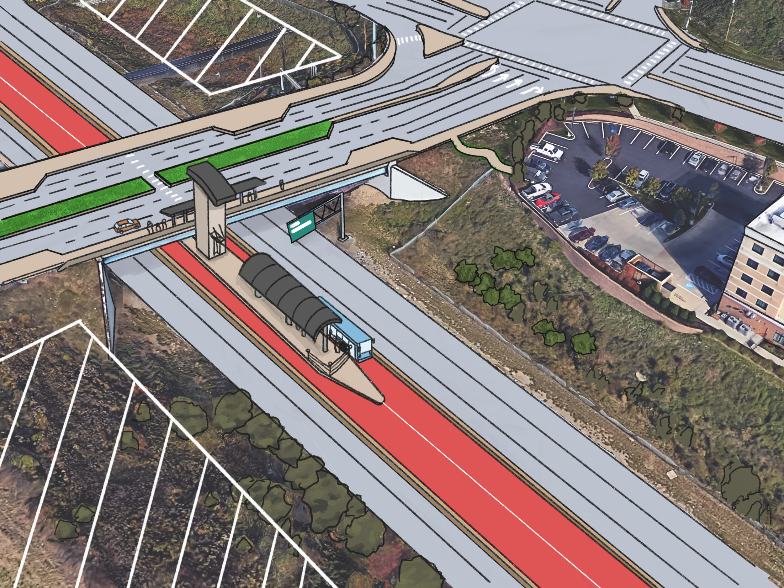
5. East Busway to Monroeville Rapid Transit
Rapid transit to Monroeville (and the job centers and neighborhoods in the eastern suburbs along the Parkway East corridor) are important for our region not only due to the need for a fast, efficient, and high-quality transit link between the eastern edge of Allegheny County (and into Westmoreland County) and Downtown, but for the municipalities east of Pittsburgh that have experienced population shifts and are poised for future growth. A rapid transit link through the Parkway East corridor that connects to the East Busway could offer quick, direct links between the East End, Oakland, the Strip District, and Downtown Pittsburgh and the eastern communities and the shopping, business, and other destinations that already exist.
6. Allentown/Downtown/Strip District LRT Best Use Study
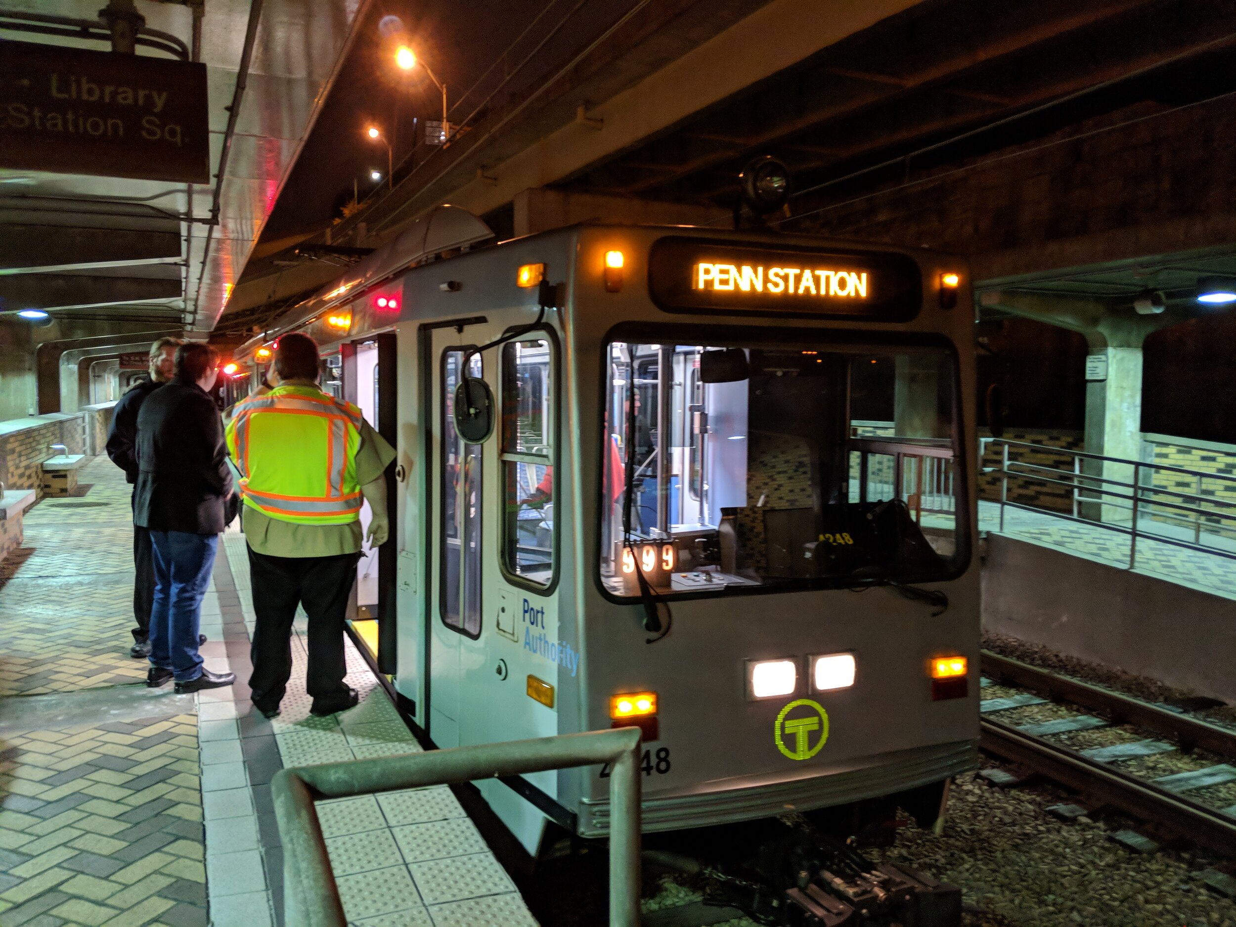
Study future uses for the light rail infrastructure in place between South Hills Junction and Station Square via Allentown as well as light rail infrastructure between Steel Plaza Station and Penn Station on the East Busway. Explore reentering into active service along one or both of these areas.

7. McKnight Road Upgraded Transit
Throughout the McKnight Road corridor, enhanced bus service can streamline travel times and reduce delays. Improvements may include traffic signals that give buses priority, lanes that allow buses to jump the queue to or through stations, and upgraded stations.
Street design upgrades to McKnight Road will increase safety and connectivity for visitors and employees of local businesses with continuous sidewalks, which also makes for a more inviting and walkable environment.

8. Allegheny Valley Rapid Transit
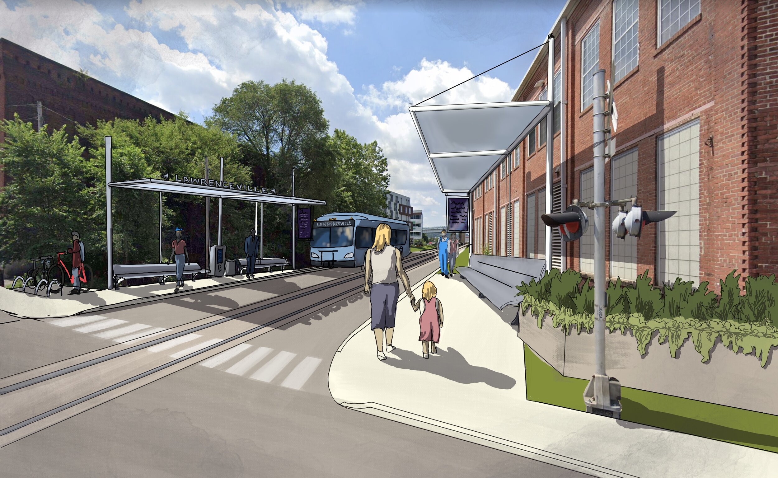
Study the potential for a rapid connection along the Allegheny Valley’s south bank corridor. This could connect places from New Kensington to Oakmont, Verona, the Pittsburgh Zoo, Lawrenceville, the Strip District, and Downtown Pittsburgh. Study the potential use and integration of the Brilliant Branch railroad line and the Brilliant Bridge, the East Busway, and transit connections along the north bank of the Allegheny River.
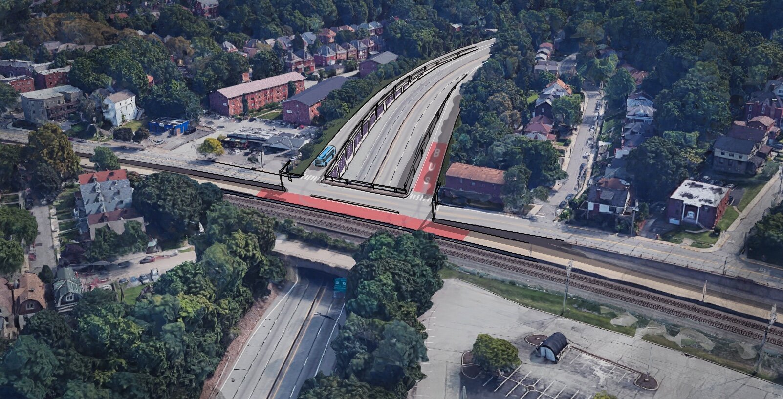
9. East Busway Phased Extensions
Study the potential for a rapid connection between Braddock and McKeesport via East Pittsburgh. This connection should include revisiting the 2017 feasibility study of an extension of the East Busway between Swissvale and Braddock and utilizing the proposed segment of the Mon Fayette Expressway between East Pittsburgh and McKeesport, with on street bus rapid transit filling in any gaps in dedicated right of way. East Pittsburgh should be considered a major transit hub in this study, with additional future projects extending from here to US-30 towards Irwin and the Turtle Creek Valley (to Trafford).
10. Airport Corridor Rapid Transit
Rapid transit to Pittsburgh International Airport (and the job centers at and on the way to it) are important for our region not only due to the need for a fast, efficient, and high-quality transit link between the Airport and Downtown, but for the municipalities west of Pittsburgh that are thriving and growing in population and new jobs. An Airport Corridor Rapid Transit link could offer quick, direct links from Downtown Pittsburgh to the western communities and the shopping, business, and other destinations that already exist. While connectivity in some of these areas is not as dense as desired for the most robust forms of transit-oriented development, connectivity can be provided through connections with smaller circulator services or other first-last mile solutions that can be part of future station area planning in places like Robinson Township.

What’s on the map?
Many individual project segments shown previously have now been grouped together and organized logically to follow main corridors, provide logical linkages to each other, and to allow for a phased approach to design and funding. We utilized your input to group projects and develop the priority order.
For the purposes of this phase of the NEXTransit planning process, PROJECTS are infrastructure improvements envisioned from 2022 through 2045 that will enable better, faster, and more reliable transit service throughout the County. The Projects Map illustrates infrastructure improvements. Map alignments indicate relative locations and areas served rather than exact locations. Exact locations of infrastructure will be determined through additional public involvement when the time comes for each project to be planned, designed, and built.

How were the projects ranked and scored?
Let’s walk through the process.


All NEXTransit Proposed Projects by Phase
Click each header below to expand the list of projects proposed for each phase over the next 25 years. Remember, the phases indicate when PRT will start planning for each project, not when it will be built. Each project will kick off its own public outreach effort when the time comes.
This ordering is subject to change based on public input, so please give us yours!
+ NEXT Projects

Study the potential for a new transit connection between the Strip District, Hill District, Oakland, Hazelwood, and points across the Monongahela River towards Overbrook and areas in the South Hills in need of direct Oakland connections. This study should also include the potential for this connection to be made via Second Avenue to tie in with the Downtown-Uptown-Oakland-East End Bus Rapid Transit project so as not to create redundancies if it is advanced before the Second Avenue corridor project. This new connection should include study of both a new station in the Strip District along the East Busway and a vertical connection between the Strip District or Northeastern Downtown Pittsburgh and the Hill District.

Downtown is the center of PRT’s transit network, and an obvious site for a transit hub. Ideally, a Downtown transit center would be situated in such a way that allows for easy walking connections to both destinations in the core as well as connections from one rapid transit line to another. The more central the location, the more destinations can be reached by walking/rolling in a short amount of time.

PRT will undertake a study of the Library Line due to its imminent need for $450 million worth of infrastructure upgrades to ensure that the best use of capital needs long-term is determined. This could include changing service or mode uses of the line or focusing on the infrastructure in place and ways to partner with municipalities to improve its usage.

Design transit and right-of-way solutions along this corridor that support transit riders through stop optimization, shelter placement, accessible pedestrian pathways, transit reliability and travel time improvements for transit vehicles. This corridor would extend the existing 61C bus route corridor planned by the Downtown - Uptown - Oakland - East End Bus Rapid Transit project. Study the potential for a major transit hub in Homestead with local service tie-ins.
+ 1-5 Years

Study the potential for a rapid connection between Braddock and McKeesport via East Pittsburgh. This should include feasibility of an extension of the East Busway between Swissvale and Braddock as well as the feasibility of dedicated right of way along the new stretch of the Mon Fayette Expressway between East Pittsburgh and McKeesport, with on-street bus rapid transit filling in any gaps.

Study future uses for the light rail infrastructure in place between South Hills Junction and Station Square via Allentown as well as light rail infrastructure between Steel Plaza Station and Penn Station on the East Busway. Explore reentering into active service along one or both of these areas.

Study the potential for a rapid connection between the eastern suburbs and Downtown Pittsburgh (via the East Busway and the Parkway East corridors) via Churchill and a possible new connection to the East Busway in the Edgewood area. Both Churchill and Monroeville should be included for study as transit hubs in this analysis, with local service tie-ins.

Design transit and right-of-way solutions along this corridor that support transit riders through stop optimization, shelter placement, accessible pedestrian pathways, transit reliability and travel time improvements for transit vehicles.
+ 5-15 Years

Study the potential for a rapid connection along the Allegheny Valley’s south bank corridor. This could connect places from New Kensington to Oakmont, Verona, the Pittsburgh Zoo, Lawrenceville, the Strip District, and Downtown Pittsburgh. Study the potential use and integration of the Brilliant Branch railroad line and the Brilliant Bridge, the East Busway, and transit connections along the north bank of the Allegheny River.

Study the potential for a rapid connection along the Downtown - Parkway West - Pittsburgh International Airport corridor. This corridor has significant congestion delay, and job growth in the Airport Corridor is increasing the demand for trips. A high-capacity alignment along or near the Parkway West corridor, including the Robinson area, and extending the existing rapid transit terminating in Carnegie along the West Busway should be prioritized. Additionally, the area between the West Busway and Downtown Pittsburgh needs to be included in this study to ensure that both the existing West Busway corridor and future rapid Airport services are reliable.

Design transit and right-of-way solutions along this corridor that support transit riders through stop optimization, shelter placement, accessible pedestrian pathways, transit reliability and travel time improvements for transit vehicles. Include study of a potential Overbrook transit hub with local service tie-ins.

Study the potential for an extension of the light rail system beyond the Allegheny Station terminus in the North Side of the City of Pittsburgh to the Manchester/Chateau area and further along the Ohio River Blvd corridor to Emsworth.

Study the potential for an extension of the light rail system beyond the North Side Station spur in the North Side of the City of Pittsburgh to the north via the lower Northside and then along the Perrysville Ave corridor to Ross Township.
15-25 Years

Study the potential for a rapid connection between Downtown/North Shore and Ross via an exclusive 2-way transit facility following the Parkway North corridor, and continued rapid or commuter-based transit service (depending on ridership projections) continuing north as far as Cranberry Township in Butler County. Ross should be considered as a major transit hub in this study, with local service tie-ins.

Supported by a recent SPC study, a detailed alternatives analysis with service options should be conducted for the implementation of transit upgrades for Second Ave from Downtown to Hazelwood, with a strategic connection to the Downtown-Uptown-Oakland BRT at/near Birmingham Bridge. Additionally, feasibility of extending this corridor into Pleasant Hills with a potential Transit Hub at Century III Mall should be considered to connect with other local services.

Design transit and right-of-way solutions along this corridor that support transit riders through stop optimization, shelter placement, accessible pedestrian pathways, transit reliability and travel time improvements for transit vehicles. Explore connections between this project and the potential for Rapid Transit connections along the south shore of the Allegheny River if that project advances earlier.

Study the potential for a rapid connection between the terminus of the West Busway Rapid Transit Line in Carnegie and the Municipality of Bridgeville along the Route 50 / Chartiers Creek corridor. Carnegie should be considered a planned major transit hub in this study.